By Brent Bellamy, Creative Director and Architect
 |
Winnipeg is sometimes referred to as River City. Despite owing its very existence to the conflux of two waterways and having four distinct rivers flowing through its boundaries, the reality is Winnipeg is anything but a true river city.
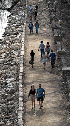
For more than a century, we have turned our back on the rivers. Travel down the Red or Assiniboine by boat and it is striking how rarely they are engaged by development. From the water it appears almost as though the city doesn't exist. Only downtown office towers that peak over the grand elm trees hint at its urban location. In Winnipeg, rivers are often crossed but they are rarely approached.
The lazy Prairie rivers that meander through the city appear benign at first glance, but their hidden power is revealed with water levels that rise as much as seven metres. These dramatic fluctuations have made it difficult to consistently develop the waterfront, resulting in a city that faces away from its rivers. |
Over the last 15 years water levels in the city have become increasingly inconsistent. The Assiniboine Riverwalk, built at a level that historically would rarely be submerged after the spring flood, is today more than two metres under water, a common summer condition. Recreational boating on the rivers has declined sharply, public docks and yacht clubs have vanished, water taxis that once carried 50,000 people per summer are not operating and the iconic paddlewheel cruises that ran for 45 years are now gone, unable to survive the unpredictability of a fluctuating river.
In 2013, a provincial review panel was created to study the operating guidelines of the city's flood control infrastructure. Part of its mandate is to consider a response to these conditions by evaluating the impact of regulating the river levels in the city year round.
Winnipeg is a city with so few natural advantages, it seems almost imperative we do everything we can to fully leverage the assets we do have. Predictable river levels would finally enable the city to turn and face the water, by creating stable conditions that improve riverbank access and allow activity to happen directly at the river's edge.
Whether situated on a lake, river or ocean, prosperous cities around the world orient themselves towards their waterways. A vibrant waterfront defines a city's image and is a quality of life improvement that helps retain young people, attract investment and increase immigration and tourism.
Generally, waterfront property is the most sought after real estate in a city, but in Winnipeg this land has often been relegated to parking lots and industrial use. Predictable water levels may be the key to changing this, by first allowing greater access to the rivers through recreational activity. Elevating public engagement of the rivers through recreation might transform their perceived value as a functioning part of the city fabric, which will increase demand and promote new development along the waterfront.
Winnipeg's low density urban sprawl has resulted in a civic government that struggles to balance its budgets, often reducing services and raising taxes in response. Urban planners are looking for solutions to create a more sustainable city by increasing neighbourhood densities and promoting infill development. Opening up the waterfront would be a significant catalyst to drive density and inward growth. With more than 240 kilometres of waterfront in Winnipeg, a number of large- and small-scale properties would become desirable infill development sites with greater accessibility to the river. Together, they would connect the city's neighbourhoods along its waterways and breathe new life into older communities by unlocking development opportunity along riverfront property that has been held back by unpredictable water levels.
Several cities in the United States have found success translating their flood protection systems into significant economic growth by regulating urban river levels. Tucked quietly below street level, the San Antonio River Walk is a vibrant oasis of shops and restaurants lining more than 20 kilometres of sidewalks and pathways that wind through the city centre. It has become the social and economic heart of the city and is the top tourist attraction in Texas. Across the state in Fort Worth, controlling the river levels is facilitating the Trinity River Vision Project, a redevelopment of industrial land that will double the size of their downtown and create an urban waterfront district adding parkland, residential units and retail activity. In Oklahoma City's Bricktown, a once underused warehouse district similar to Winnipeg's Exchange, streets were dug out to create canals that extend through the area from the river. Today, the canals are fronted with shops and restaurants transforming the area into an active entertainment district.
There are some environmental, social and economic challenges that would have to be overcome before Winnipeg could attempt to replicate these success stories and unlock the latent recreational, cultural and economic potential of its rivers.
Controlling summer river levels is not as simple as opening the Floodway gates. Summer operation would cause minor flooding of land upstream, some of which is used for market gardens and cereal cropland. A study done in 2003 indicated that a one-time buy out of these landowners would cost nearly $10 million. If one considers that the cost overruns alone for the roadways of Waverly West stand at more than $20 million, investment in an initiative that promotes city-wide sustainable urban growth, increased economic development and improved quality of life for all citizens, would seem to be a worthwhile initiative.
The Provincial Flood Control Infrastructure Operation Review Panel will table its recommendations by July 2015. The overwhelming benefits to the city seem to suggest that further steps be taken to move towards stabilizing river levels throughout the year. Engaging the impacted municipalities and small number of landowners south of the city early in the process, making them partners in the dialogue will be a critical step toward achieving a solution that is perceived as beneficial for all. The reward of this effort might be a more prosperous and sustainable city that truly embraces its rivers with active urban waterfronts, redefining Winnipeg's image and allowing it to proudly be called River City.
Brent Bellamy is senior design architect for Number Ten Architectural Group.
bbellamy@numberten.com
Republished from the Winnipeg Free Press print edition June 23, 2014 B5