Higher density key to fixing budget woes
December 9, 2024
By Brent Bellamy, Associate + Creative Director
Originally published in the Winnipeg Free Press
Alarm bells have been ringing at Winnipeg City Hall ahead of Wednesday’s 2025 budget update. It might be the annual doom and gloom dance, done to lower expectations before every budget announcement, but with the city’s rainy-day fund being emptied and a significant deficit projected, it does feel like this time the warnings are real.
Like many before him, Mayor Scott Gillingham has responded by being vocal about the need for the province to come to the table with new funding sources for the city.
Two polls — one conducted for the mayor’s office, and one for the Federation of Canadian Municipalities — were recently released in support of this campaign. The surveys identified that Winnipeggers believe the top priority for civic spending should be repairing infrastructure, with 81 per cent indicating road quality as the top civic issue impacting quality of life. A majority also believe the city needs additional municipal funding, with strong support shown for increased provincial transfers.
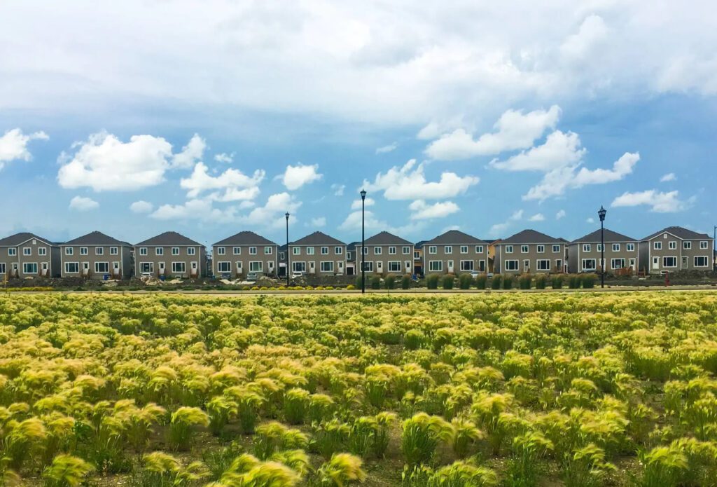
New housing near the South Perimeter Highway. Building isolated subdivisions has created a higher financial burden for Winnipeg taxpayers.
Our city has been growing three times faster in area than in population, meaning overall density has been dropping as it grows.
The only immediate solution appears to be more tax dollars, either civic or provincial, but asking taxpayers to take more money from their pockets is a Band-Aid that avoids addressing the core issue that got us here.
Winnipeg, like most Canadian cities, has been on an economic slippery slope for a long time. That slope is called suburban sprawl. It makes many people defensive to hear it, but our crippling infrastructure deficit and annual budget crunch at city hall can be directly linked to the city’s financially unsustainable, low-density growth patterns over the last 50 years.
The concept is simple. Lower density means fewer people are paying for more things. Ten people living on a street have their taxes divided by 10 to maintain the road. If only five people live on that same street, each taxpayer is responsible for twice as much. On a macro scale, this is how Winnipeg got to where it is.
Our city has been growing three times faster in area than in population, meaning overall density has been dropping as it grows. In 2019, the city compared the built-up area of Winnipeg over 50 years and found that the footprint of the city had increased by 96 per cent, almost doubling, while the population increased by only 37 per cent. If Winnipeg had simply maintained the density it had in the 1970s, the city’s footprint, and its corresponding infrastructure would be 30 per cent smaller than it is today.
This would have gone a long way to balancing our civic budgets.
From the founding of Winnipeg until the late 1960s, the city grew simply by extending the existing street grid. Ride your bike from Wellington Crescent to Taylor Avenue on any street in River Heights and you will see a different decade of houses every two blocks. As the city grew, the streets just got longer.
After this time, we started building isolated subdivisions with long stretches of infrastructure connecting them back to the older neighbourhoods. This development pattern wildly increased the city’s overall footprint and reduced its density. Every Winnipeg taxpayer is today responsible for maintaining 10 per cent more roads than they were in 2010. Fewer people paying for more things.
Greater distances between neighbourhoods meant that existing civic amenities like schools, libraries and community centres, could no longer be shared with new growth, requiring new ones to be built.
This issue was compounded by opposition to higher density, new development in existing neighbourhoods that meant, as household sizes naturally decreased, neighbourhood populations fell. Most of Winnipeg’s mature neighbourhoods have 20 to 30 per cent fewer people living in them today than 50 years ago. This resulted in existing civic amenities being underused, while at the same time we were building new ones in outer suburbs. Again, fewer people paying for more things.
The types of neighbourhoods we started building also impacted the city’s economic viability. With apartment buildings, townhouses and single-family homes mixed on every street, the higher density of mature neighbourhoods makes them far more productive at generating tax revenue than newer single-family subdivisions.
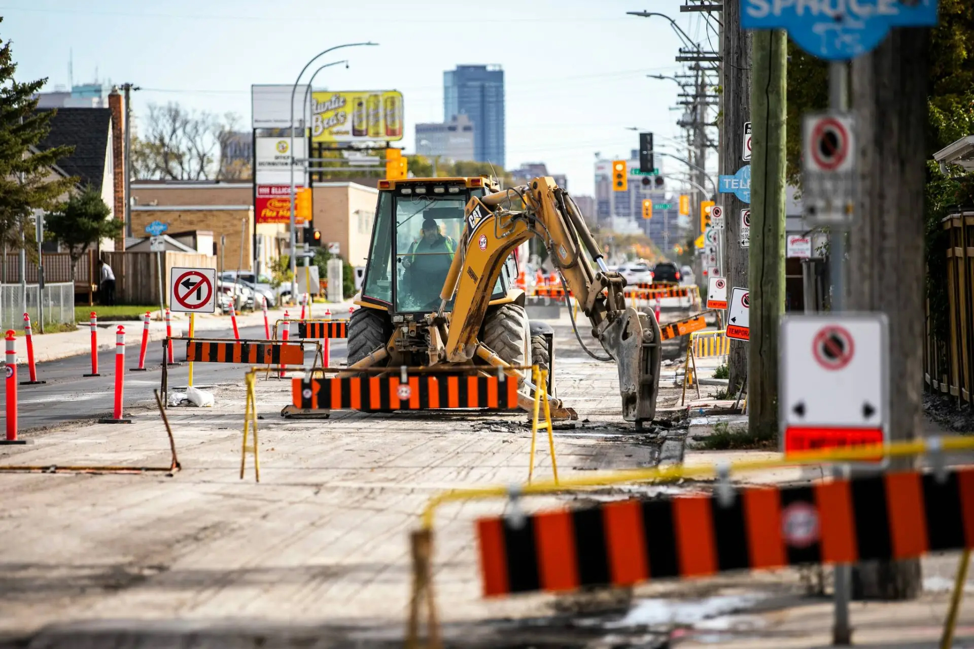
Winnipeg needs so much infrastructure and repairs because the city has spread out, instead of growing up.
Per square foot of land, the assessed tax value of neighbourhoods like Wolseley, West Broadway, and Osborne Village, is twice that of Island Lakes or Whyte Ridge.
The impacts of sprawl are not limited to where we live but also includes where we shop. Older neighbourhoods were centred along commercial streets and former streetcar lines, fronted with shops that people could walk to from their home.
That pattern has been replaced with big box stores and oceans of asphalt parking that push the footprint of the city outward. This retail development pattern is a similarly unproductive tax base. The handful of small buildings and shops on a single block of Corydon Avenue has a collective assessed tax value that is equal to a Costco in south Winnipeg that consumes five times more land area.
Longer travel distances in the expanding city has created a greater reliance on private vehicles.
Car ownership per capita has increased by 20 per cent in only 20 years, and the number of vehicles on Winnipeg’s roads increases by about 7,500 every year. This results in more parking lots and bigger roads that push the city even further out in a never-ending cycle of economically unsustainable sprawl.
The solution to the perennial budget woes at city hall requires that we take a step back and re-evaluate our city-building choices. The city is growing quickly, and the only way to become economically viable in the long term is for each of us to welcome more neighbours into our communities, allowing our city to grow inwards and upwards, instead of outwards. More people paying for fewer things.
Brent Bellamy is creative director at Number Ten Architectural Group.
Written By